
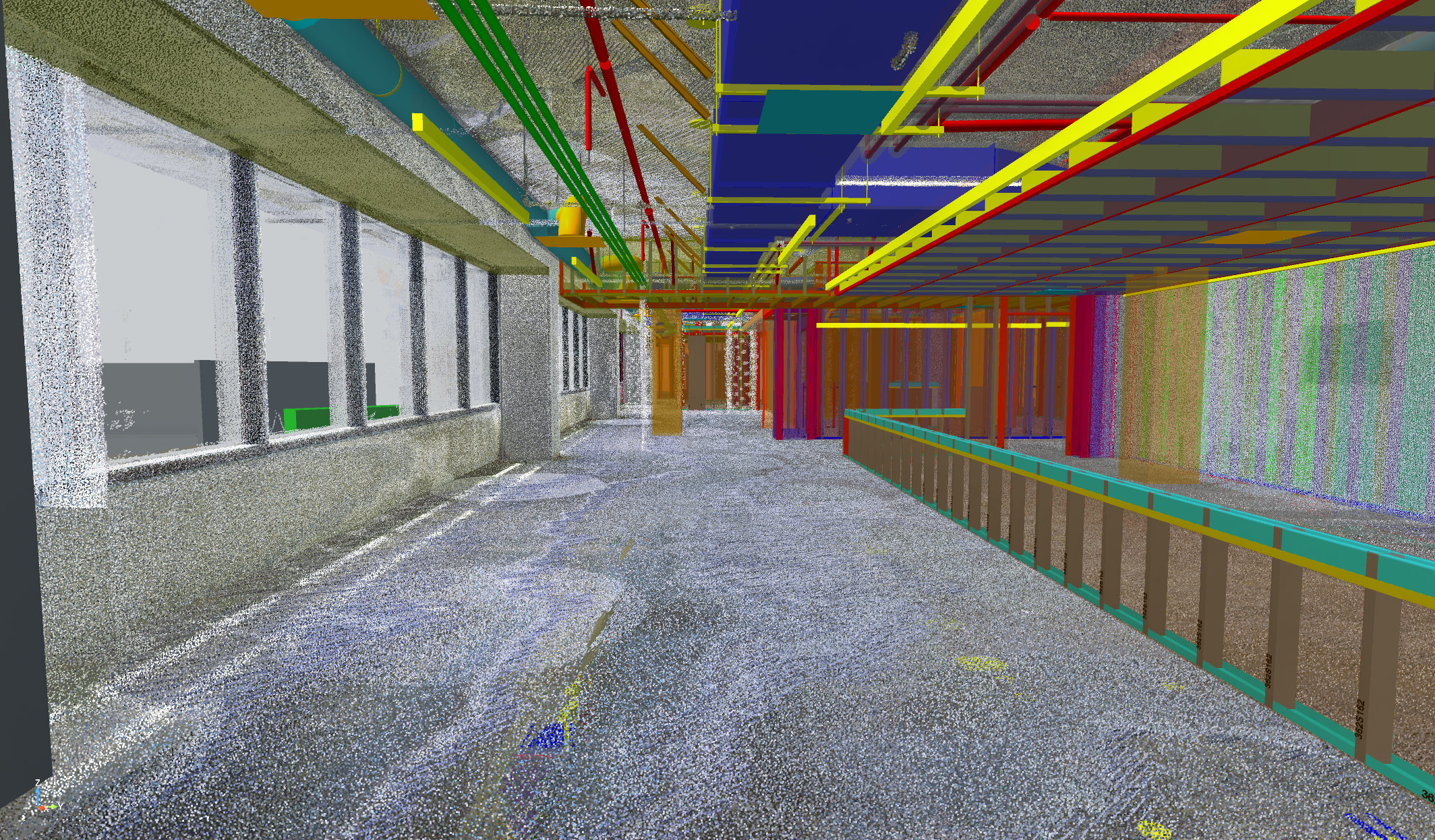
Reality Capture and Floor Flatness Verification – Laser Scanning Services
June 16, 2026
In-House Reality Capture
Keeping reality capture services in-house gives project teams faster access to accurate field data. When these capabilities are maintained internally, project teams can collect, process, and act on accurate field data without relying on third-party vendors. This improves responsiveness, consistency, and alignment with project priorities. When fully integrated into the VDC workflow, reality capture becomes a continuous feedback loop that strengthens decision-making throughout construction.
Reality capture through laser scanning is a core strength of Rudolph and Sletten’s Virtual Design and Construction Department (VDC) and a long-standing in-house capability. The team has been performing laser scanning on active construction projects since prior to the COVID era, building thousands of hours of hands-on experience capturing, processing, analyzing, and deploying point cloud data to support construction verification, quality control, and decision-making in the field.
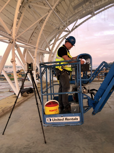
Using high-accuracy terrestrial laser scanners such as the Leica RTC360, combined with industry standard processing platforms including Leica Register 360, 3DR, and Rithm, the VDC team delivers reliable, and construction-grade reality capture services without reliance on third-party vendors. This enables scanning to be strategically planned and executed in alignment with project milestones, sequencing, and active field operations.
How Reality Capture Works During Active Construction
Laser scanning is deployed throughout construction to document existing conditions, validate installed work, and provide a verifiable digital record of site progress. Scans are captured during key phases including structural work, concrete placement, MEP rough-in, and architectural build-out, ensuring conditions are preserved before work becomes concealed.
When paired with 360-degree photo documentation platforms such as Cupix, reality capture provides both context and precision. Photography delivers visual understanding of field conditions, while point clouds provide accurate measurement and coordination data. Together, these tools are especially valuable for issue resolution, change management, trade coordination, and owner communication.
Floor Flatness and Slab Quality Verification
One valuable use of laser scanning is verifying slab flatness during concrete operations. By scanning slabs at the appropriate time, the VDC team generates objective, data-driven assessments of slab flatness and surface deviation.
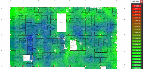
Deliverables include:
- Color-coded floor flatness heatmaps that clearly visualize high and low areas
- Quantitative flatness reporting to support compliance reviews
- Early identification of out-of-tolerance conditions while remediation options remain viable
These outputs allow project teams to move beyond subjective field checks and instead rely on defensible, measurable data to support discussions with trade partners, mitigate downstream impacts to finishes and equipment installation, and reduce rework risk.
Standard Deliverables from Reality Capture
The laser scanning workflow produces multiple deliverables tailored to construction use cases:
- Registered Point Clouds
- High-resolution point clouds processed in Leica Register 360
- Delivered in formats compatible with Revit and Revizto
- Used for as-built verification, model validation, coordination, and progress comparison
- Enables direct overlay of design and installation to identify deviations early
- Revit and Revizto Integration
- Point clouds are optimized for use in live construction coordination models
- Field conditions can be reviewed directly within platforms already used by the project team
- Eliminates re-modeling assumptions and improves confidence in model-based decisions
- Floor Flatness Reports and Heatmaps
- Visual and numerical representations of slab surface variation
- Simplifies communication with concrete trades and ownership teams
- Supports proactive quality management rather than reactive correction
- Mesh Models Derived from Point Clouds
- Lightweight mesh geometry created from scan data
- Useful for visualization, spatial analysis, and comparison against design intent
- Provides an intuitive representation of complex or irregular conditions
Measurable Project Value
Together, these services help teams make more informed decisions based on reliable field data. By maintaining scanning capabilities fully in-house, the VDC department ensures consistency, responsiveness, and direct alignment with project priorities. As scanning continues to evolve, the team is actively evaluating opportunities to further streamline capture workflows and safely expand scanning during active operations, such as during concrete placement, to maximize value without disrupting field production.